Process
INTRODUCTION/OVERVIEW
McCordsville Bike and Pedestrian Plan
The Town of McCordsville desires to assess their current system and determine the best routes, locations, and facilities for a powerful, accessible, and connected network of bike and pedestrian facilities for the growing community.
The future plan shall connect to the efforts of the Hancock County Trails Plan, City of Fishers, City of Lawrence and adjacent towns and cities to create a larger inter-connected plan and encourage the community to bike and walk for means of community pride, transportation, recreation, fitness, and a healthy lifestyle.
The following opportunities will be pursued as Goal and Objectives:
- Increase the number of people walking and biking for everyday transportation purposes by ensuring the trails plan connects people to destinations.
- Increase the number of people walking and biking for recreation by creating a trail plan that provides highly accessible and desirable recreation opportunities.
- Provide guidance and suggested priorities for future bike/ped projects.
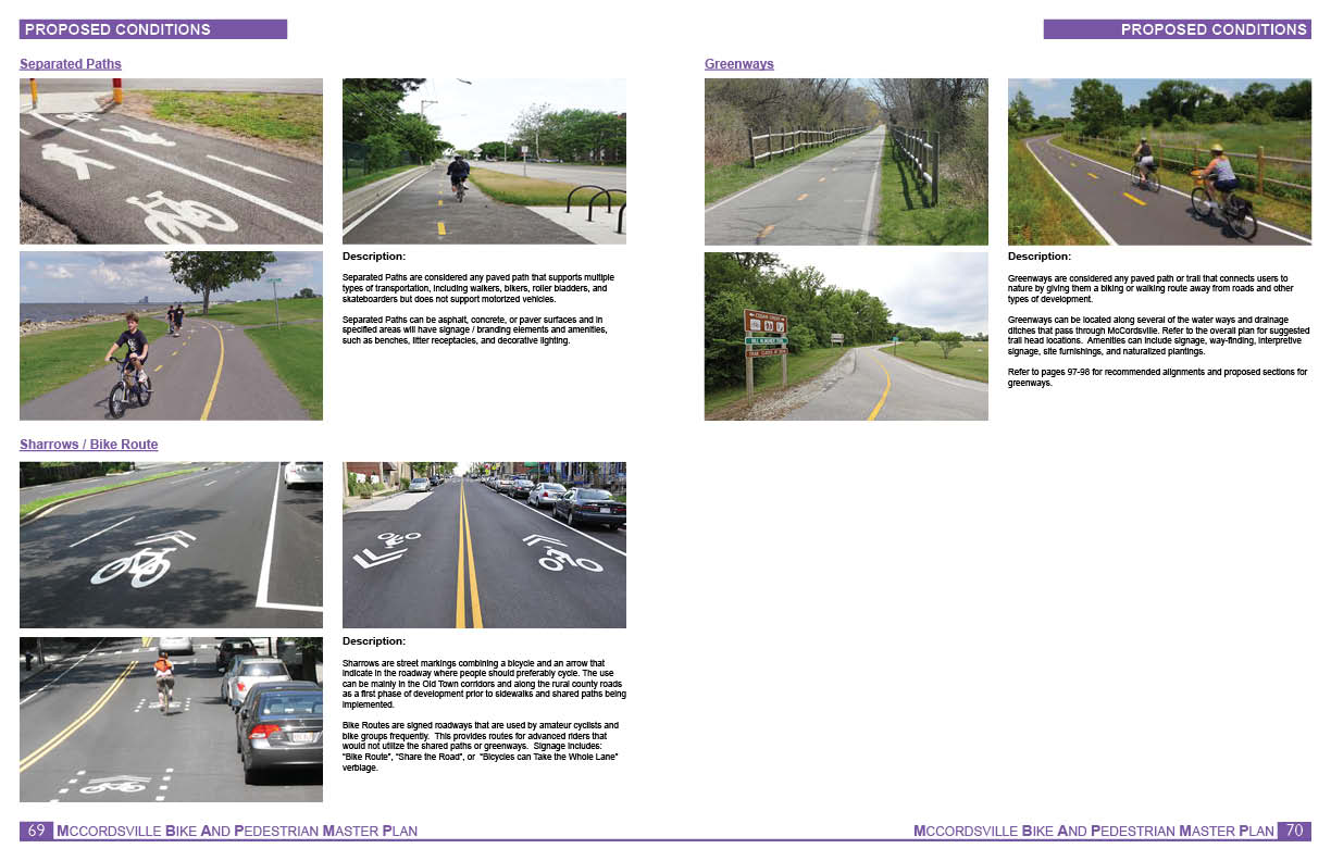
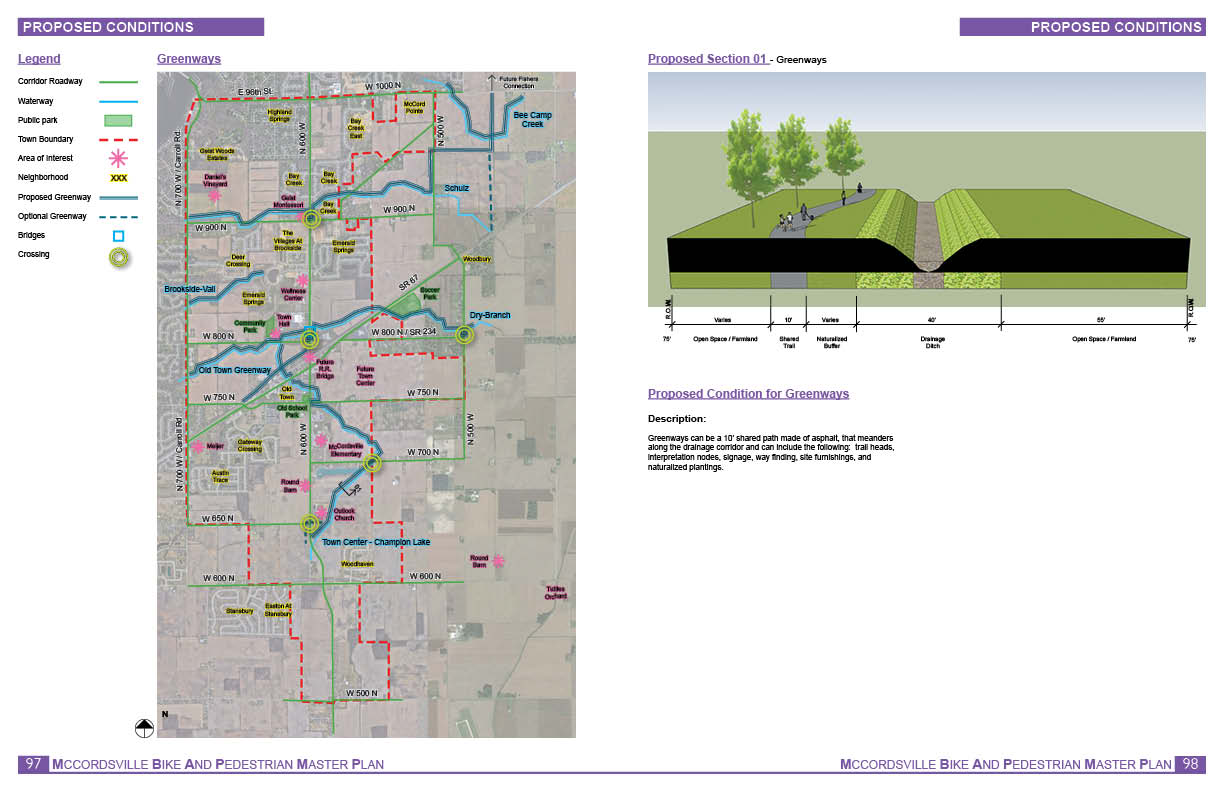
- Provide feasibility analysis of multi-use trails along riparian corridors.
- Assess current trail infrastructure conditions, and develop a trail pavement maintenance plan.
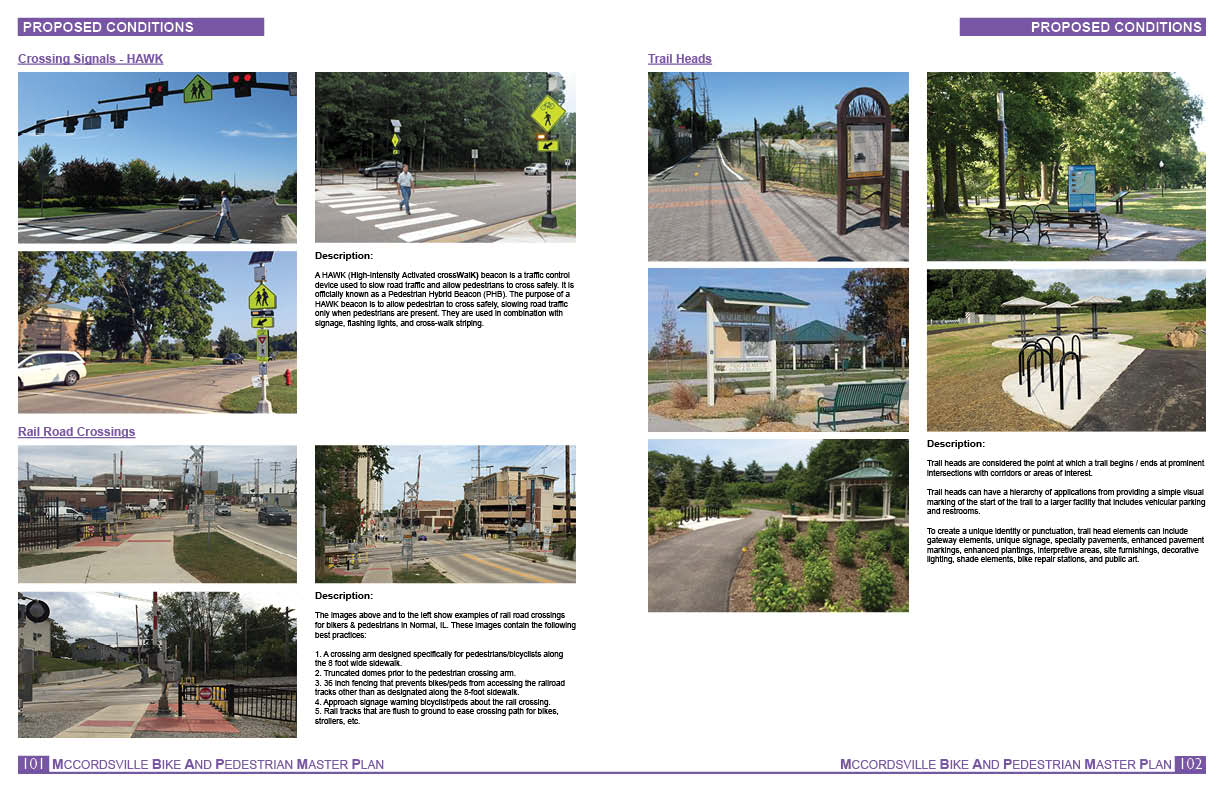
- Establish safe and functional routes for bicycles and pedestrians between community destinations.
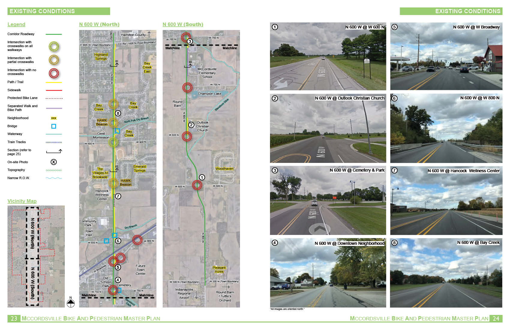
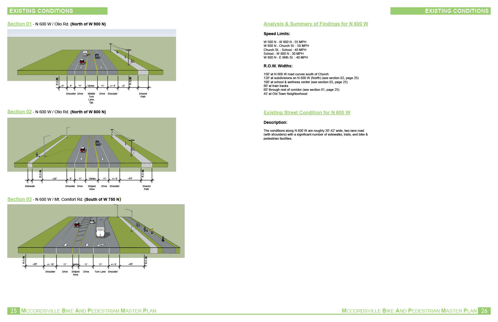
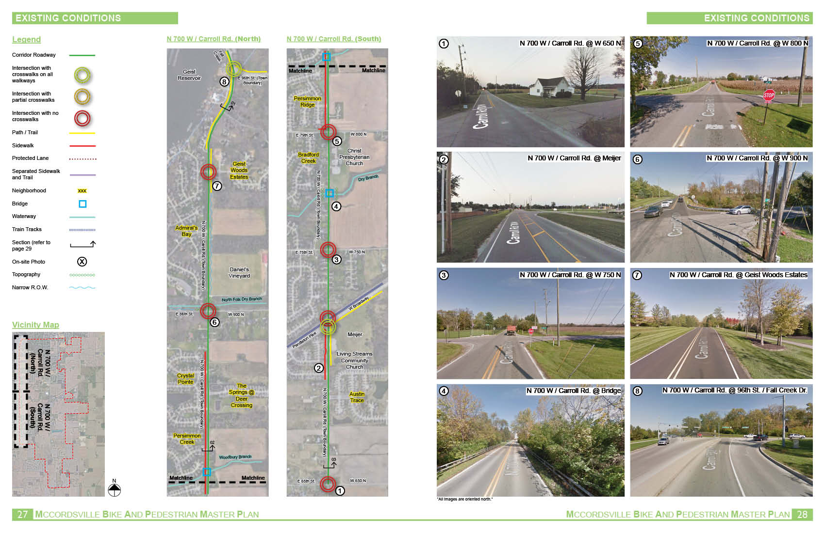
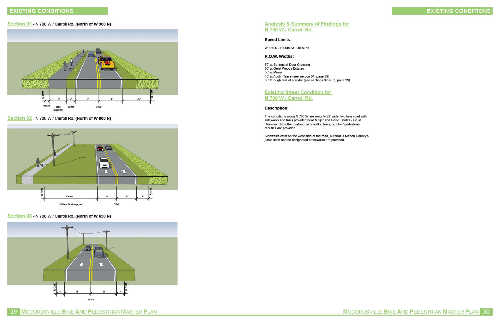
- Determine what, if any, improvements, upgrades, connections, or other facilities should be provided to allow for CR 600W to be the main bike/pedestrian corridor through the Town.
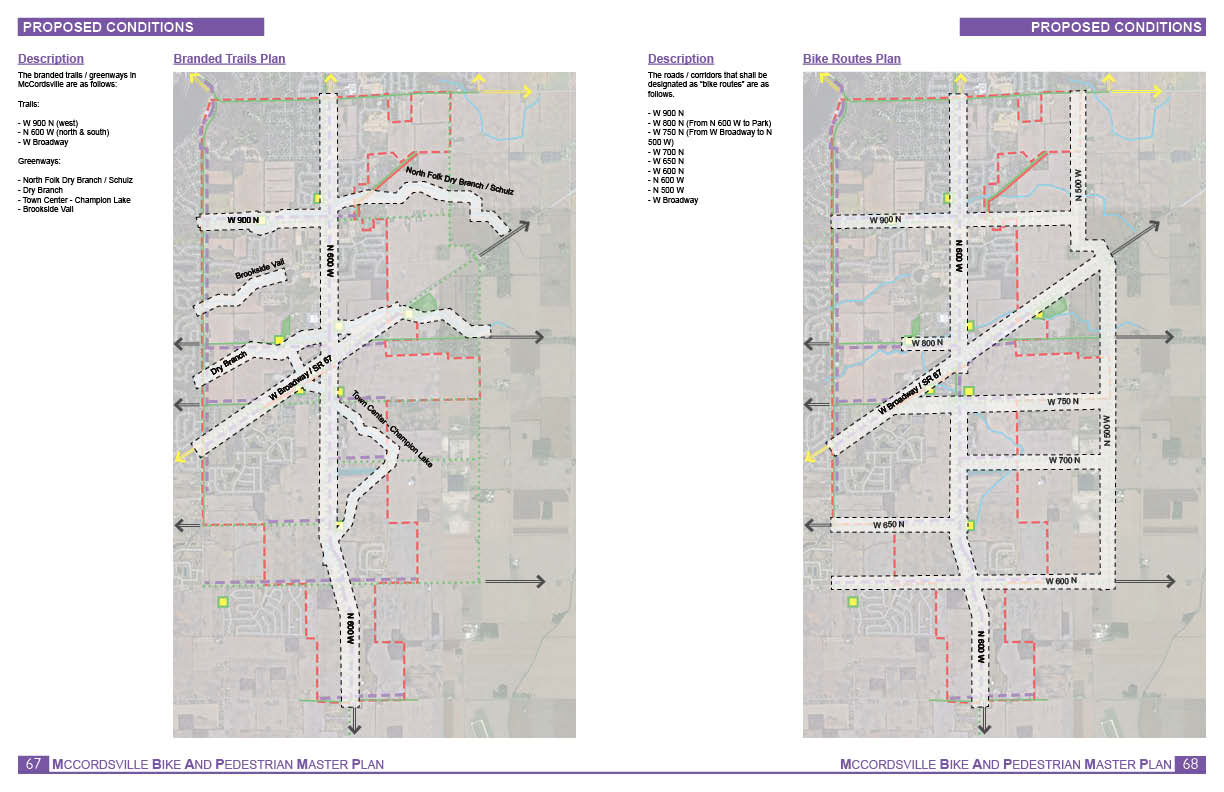
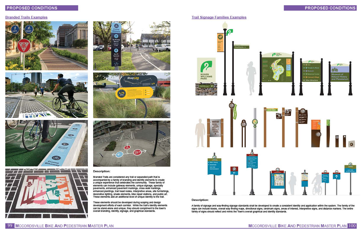
- Identify which trail opportunities, if any, should be “branded” trails.
Click here to download a DRAFT version of the plan booklet.
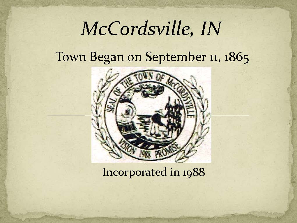
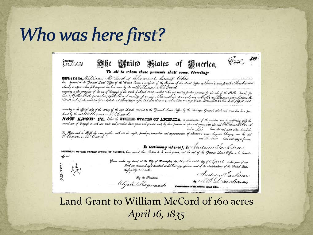
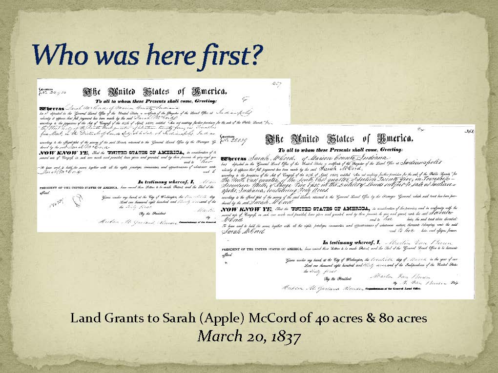
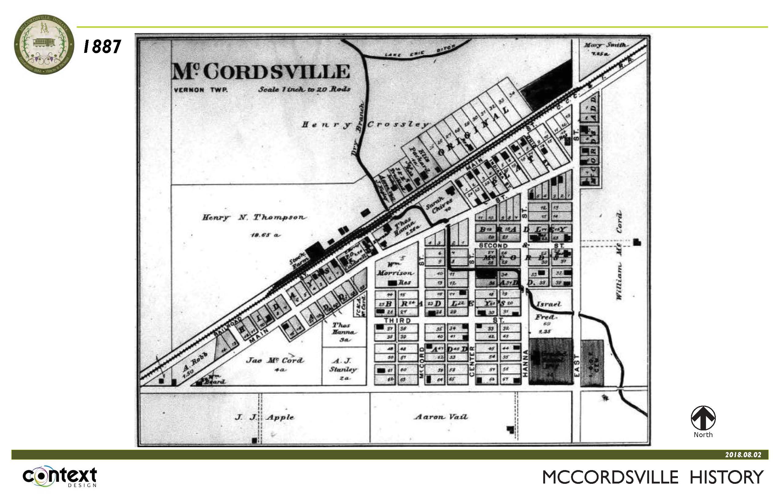
HISTORY OVERVIEW
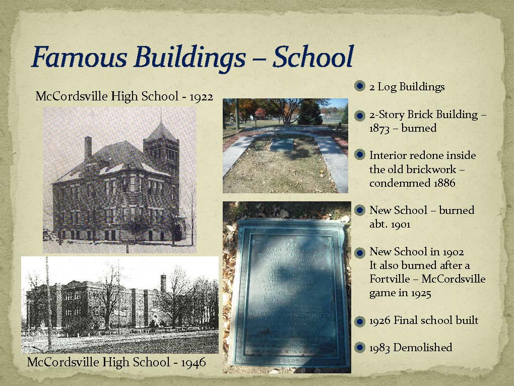
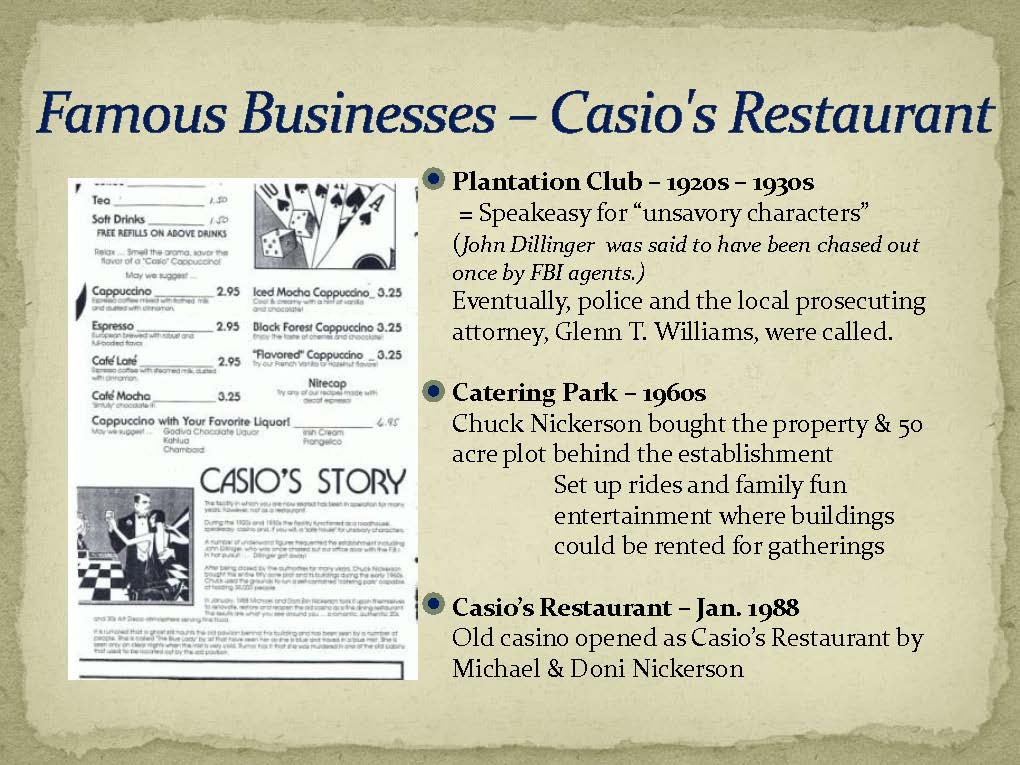
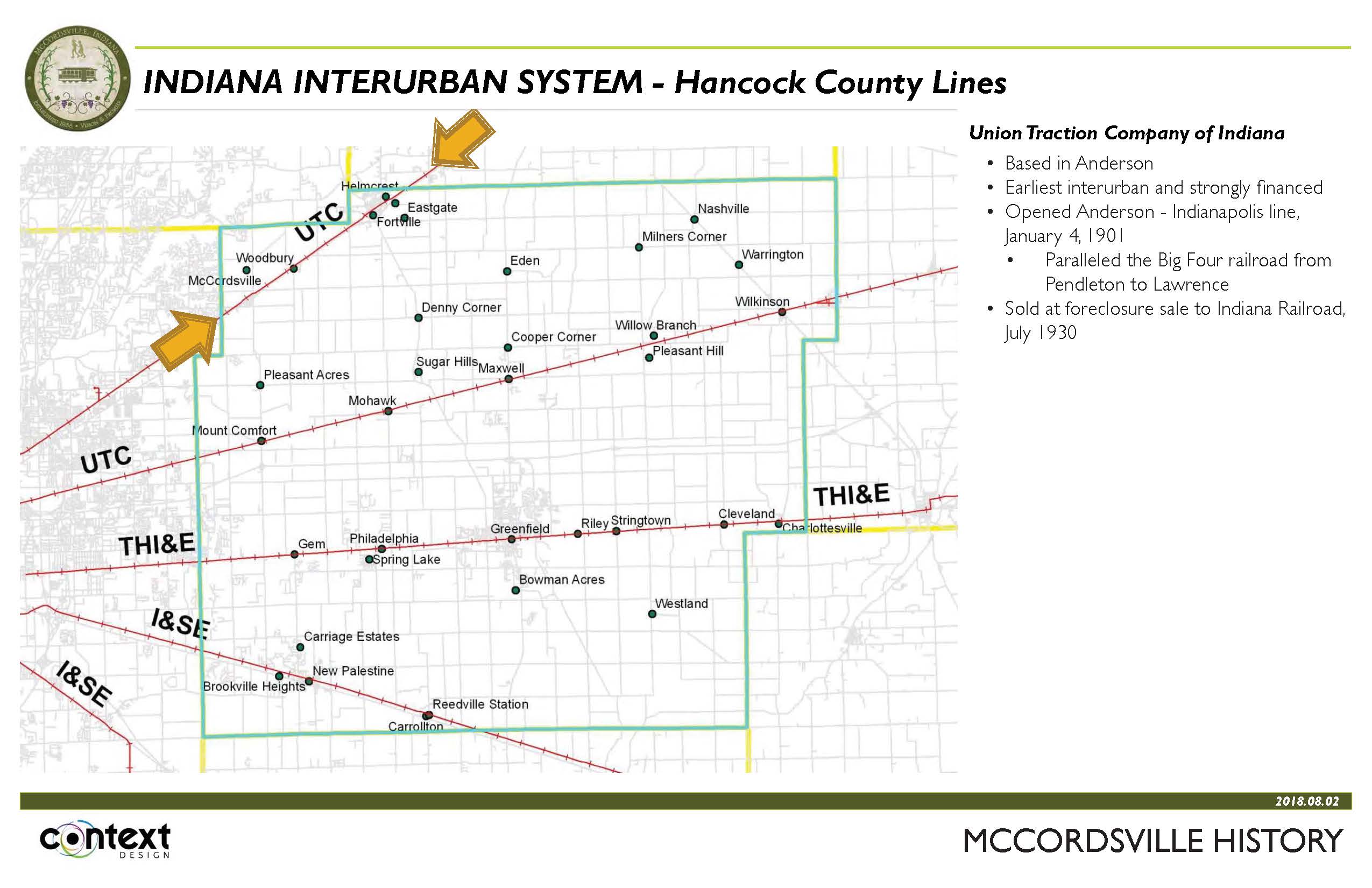
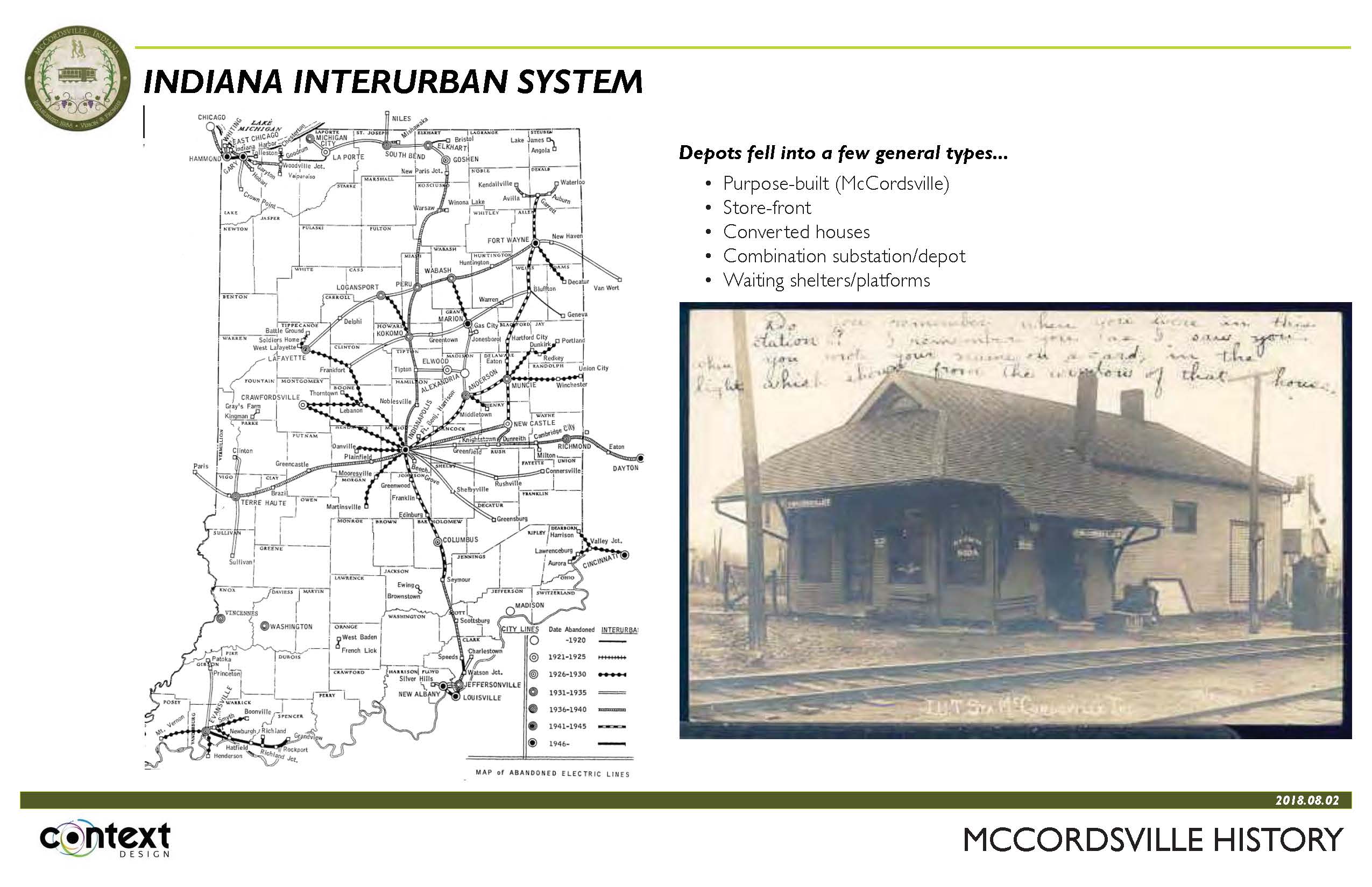
Photos, text and imagery about the history of the Town of McCordsville
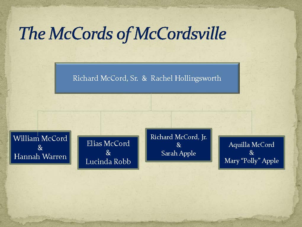
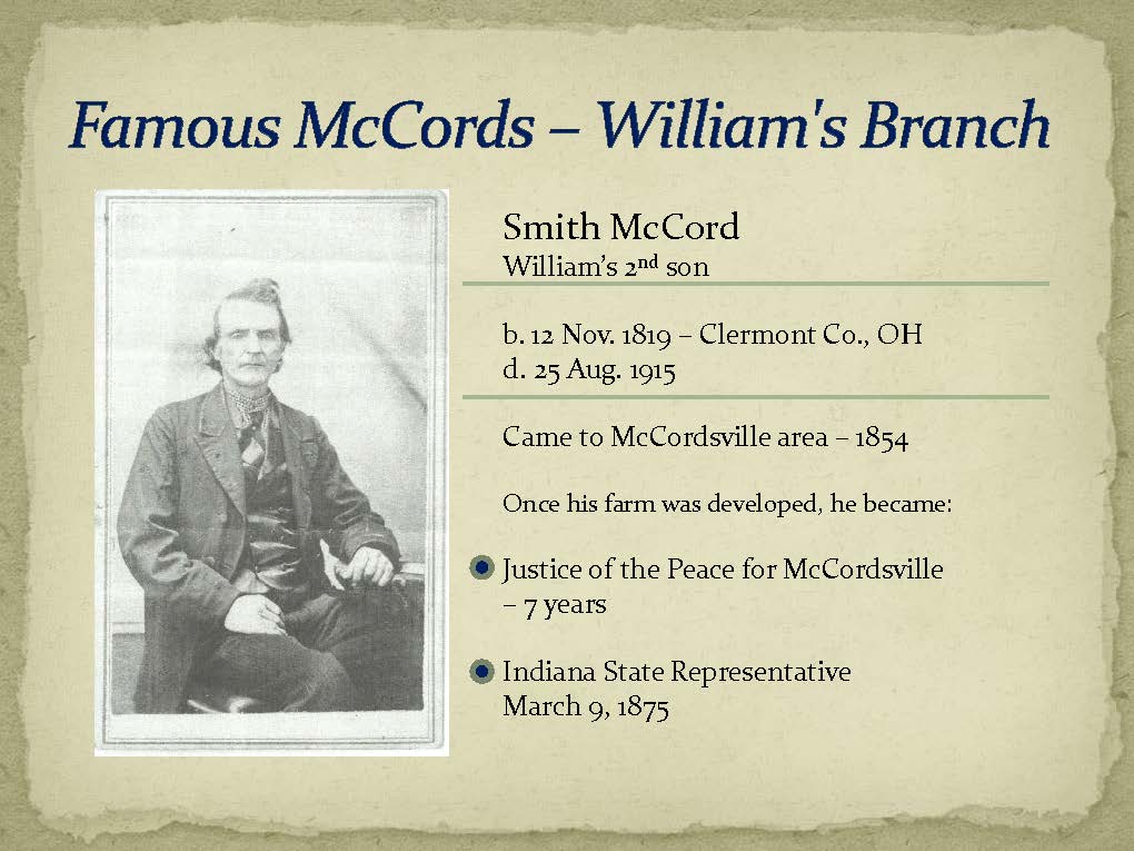
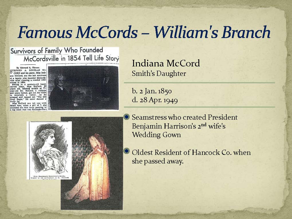

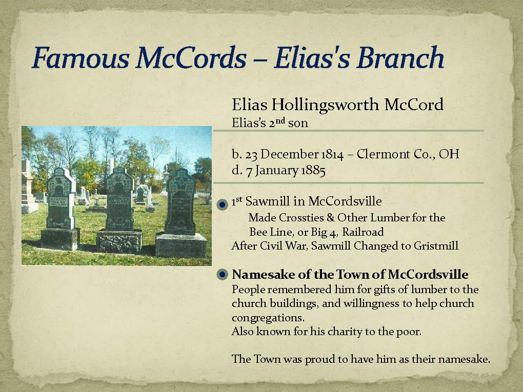


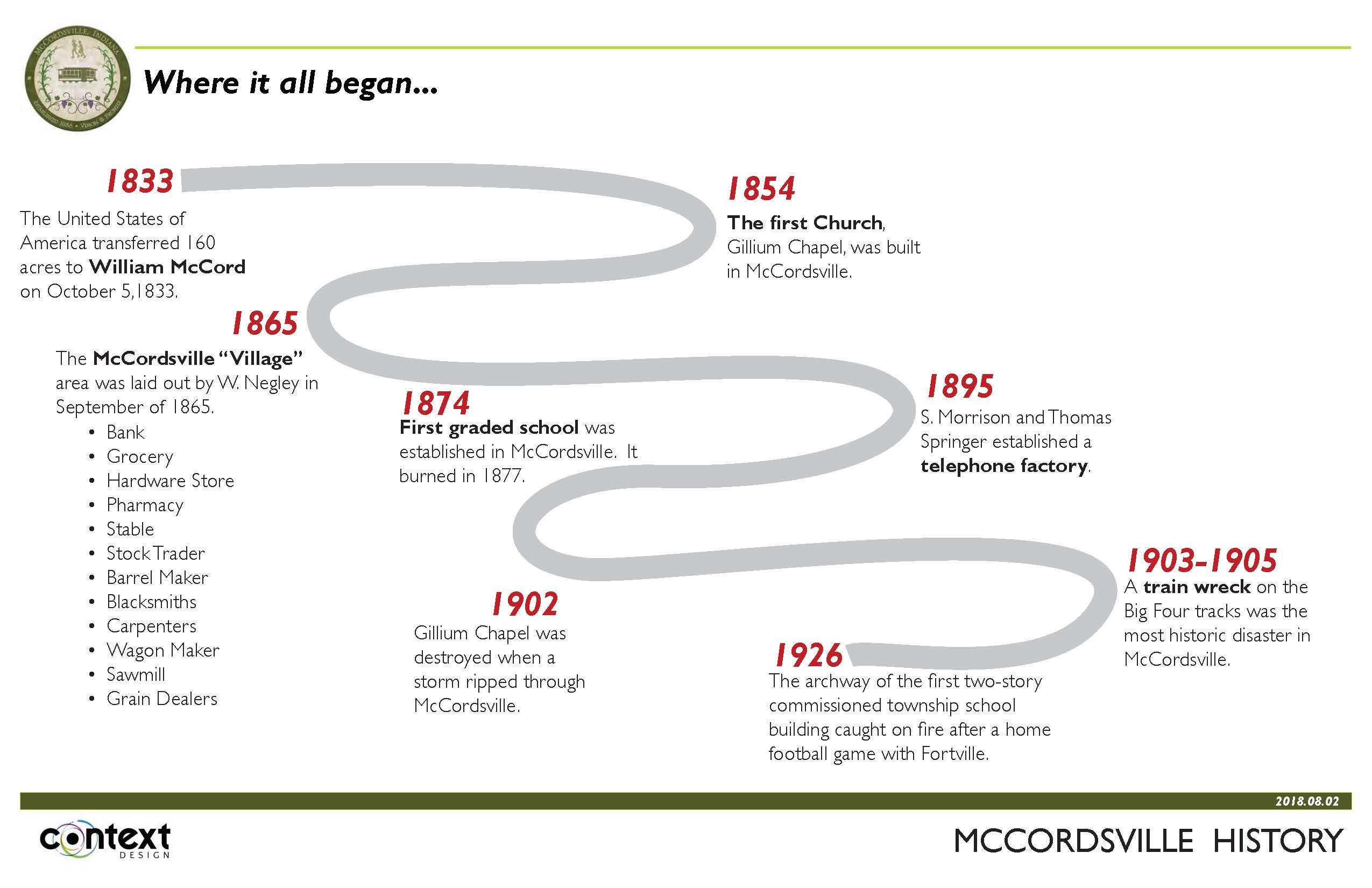
For additional reading, download a “A Brief History of McCordsville” compiled by Rebecca Crowe.


PUBLIC SURVEY
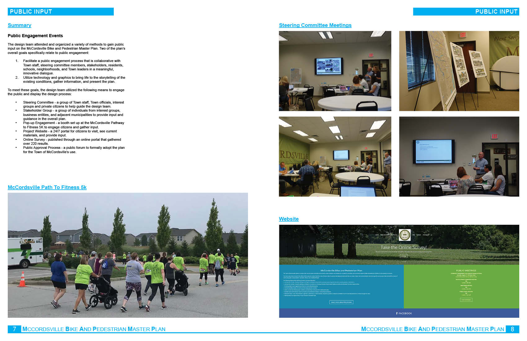
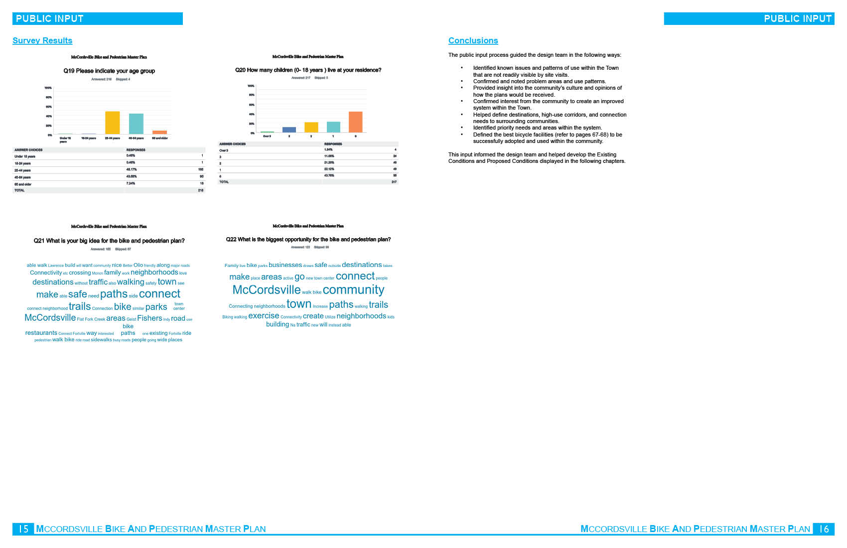
The design team attended and organized a variety of methods to gain public input on the McCordsville Bike and Pedestrian Master Plan. Two of the plan’s overall goals specifically relate to public engagement:
- Facilitate a public engagement process that is collaborative with Town staff, steering committee members, stakeholders, residents, schools, neighborhoods, and Town leaders in a meaningful, innovative dialogue.
- Utilize technology and graphics to bring life to the storytelling of the existing conditions, gather information, and present the plan.
To meet these goals, the design team utilized the following means to engage the public and display the design process:
- Steering Committee – a group of Town staff, Town officials, interest groups and private citizens to help guide the design team.
- Stakeholder Group – a group of individuals from interest groups, business entities, and adjacent municipalities to provide input and guidance in the overall plan.
- Pop-up Engagement – a booth set up at the McCordsville Pathway to Fitness 5K to engage citizens and gather input.
- Project Website – a 24/7 portal for citizens to visit, see current materials, and provide input.
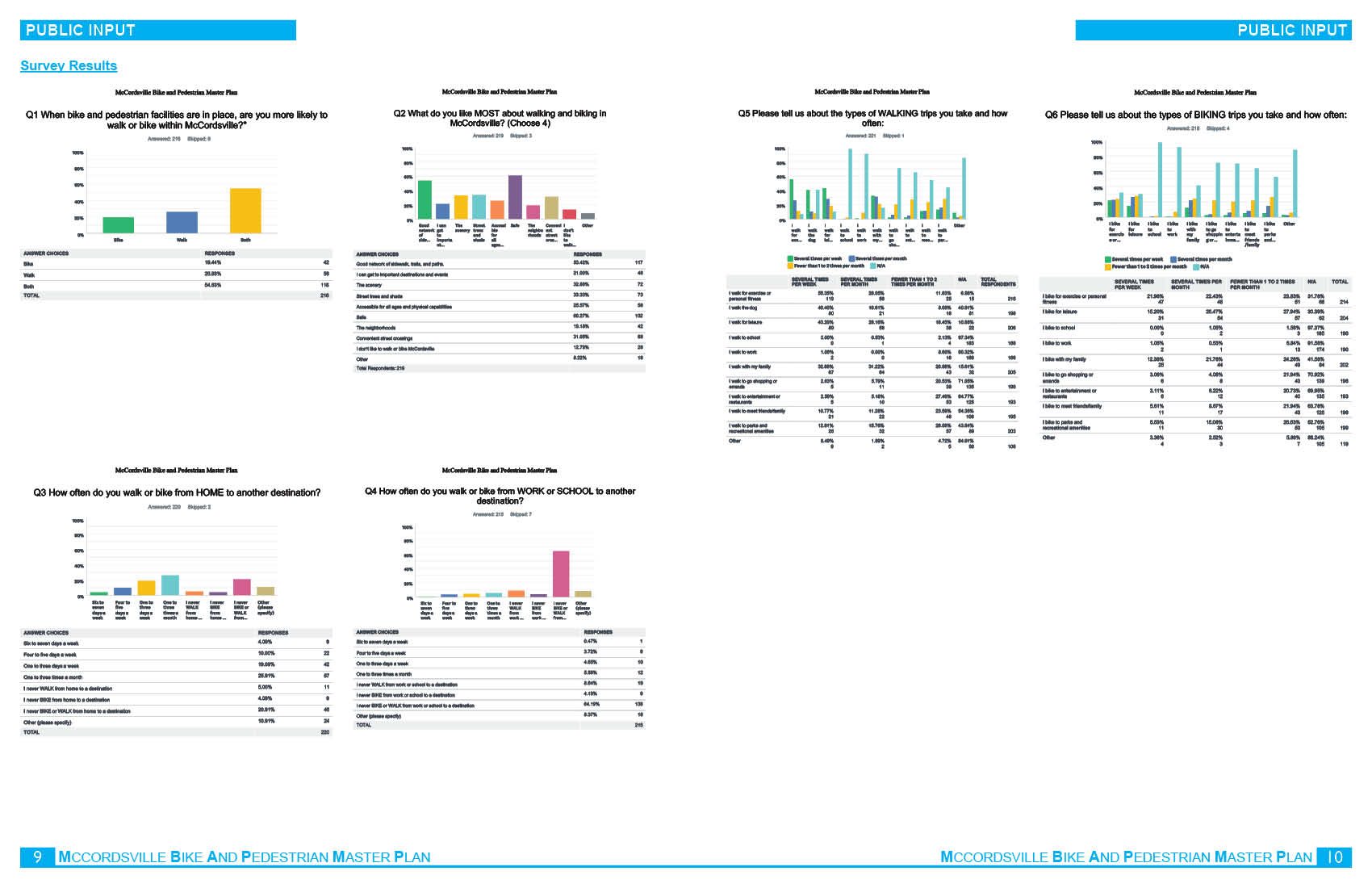
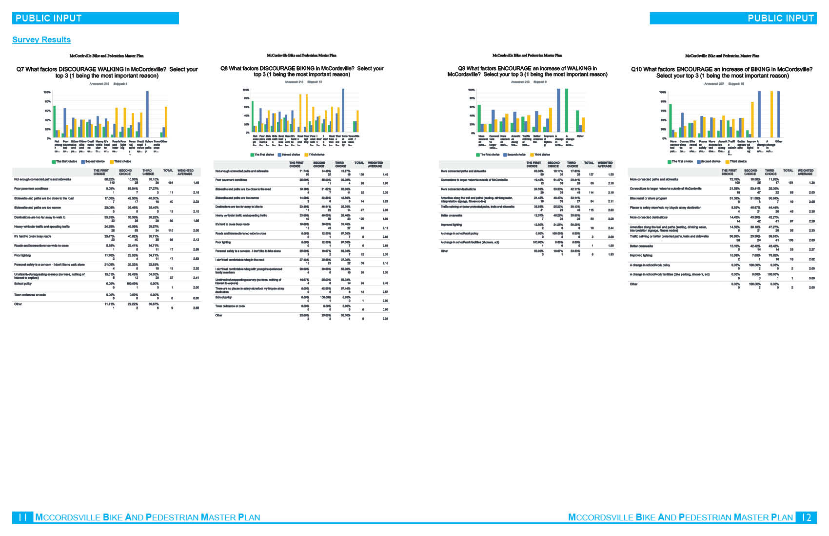
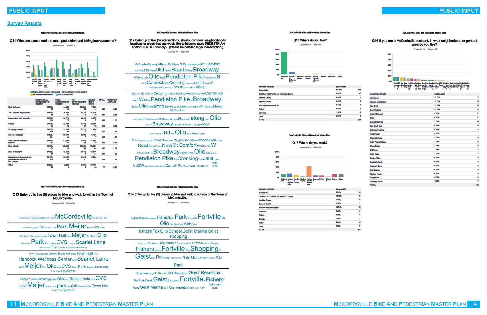
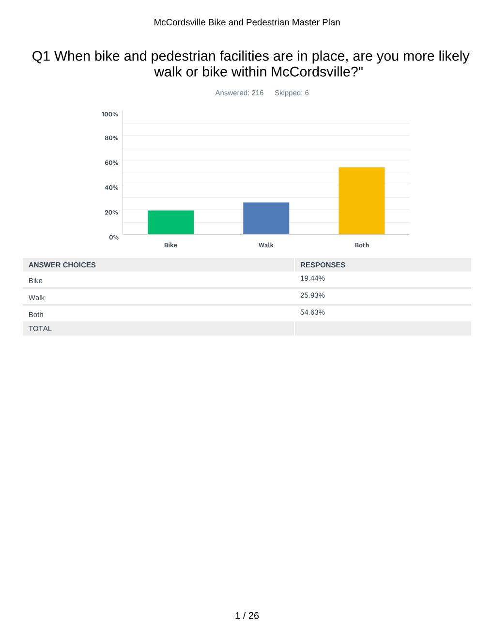
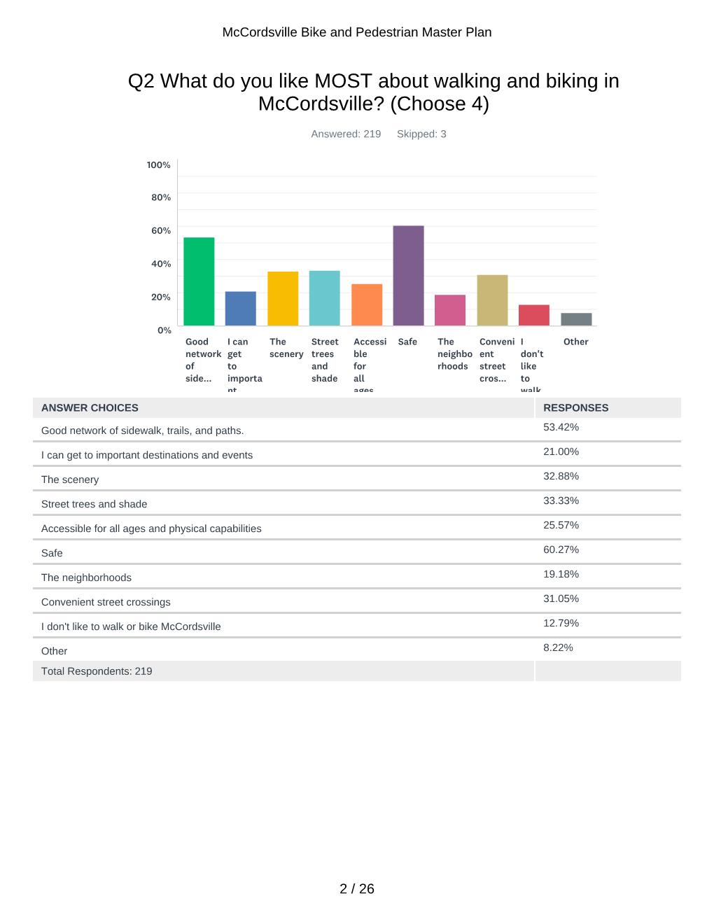
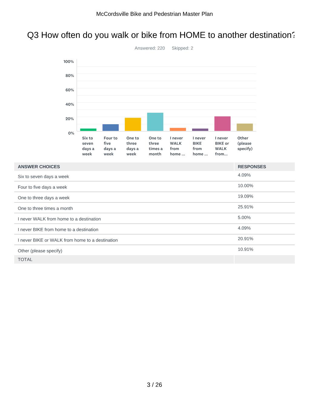
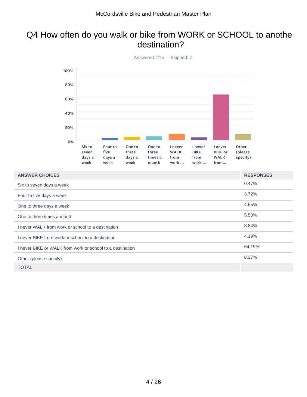
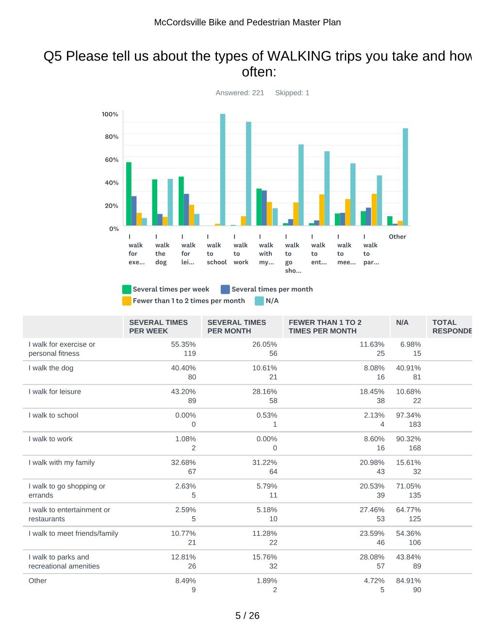
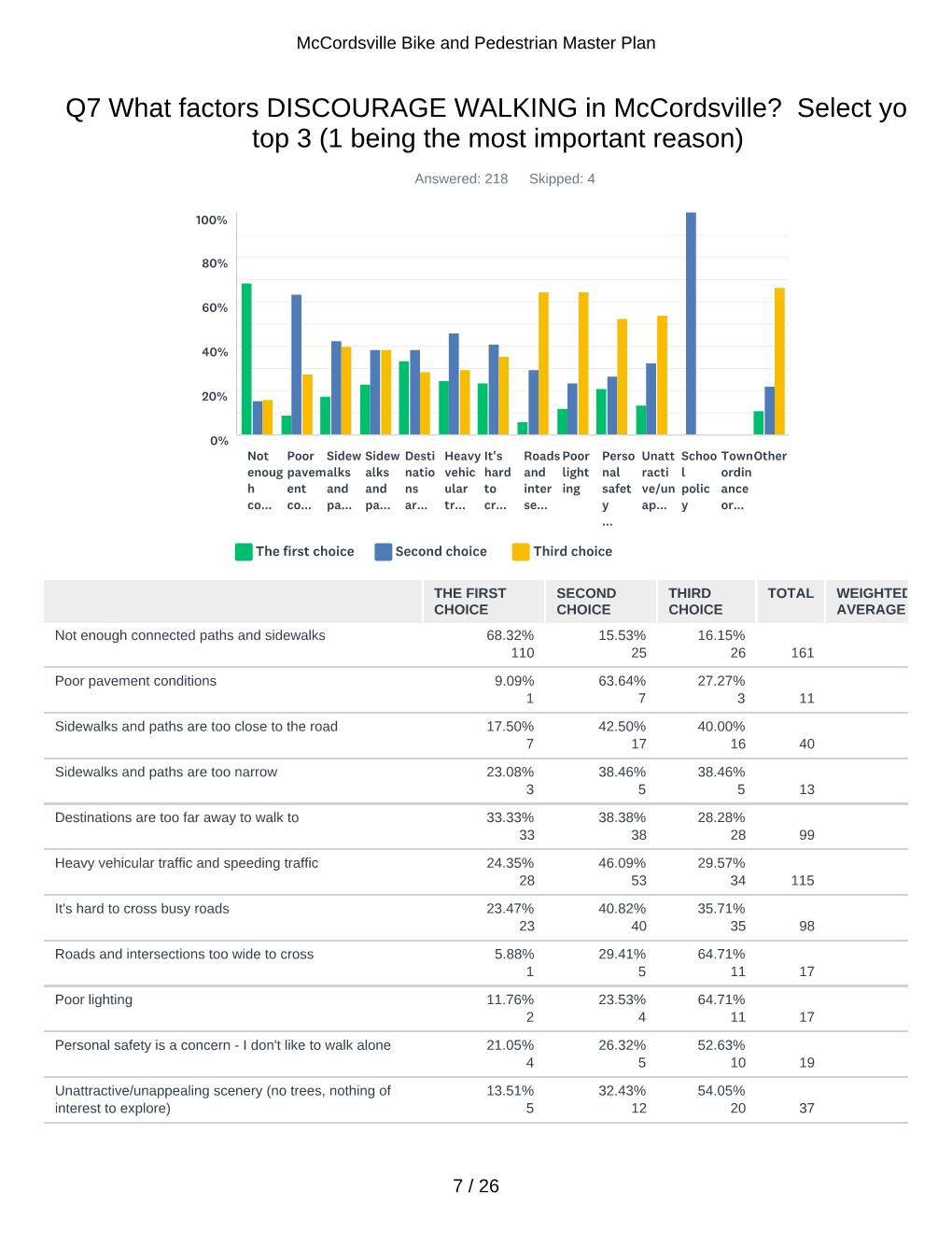
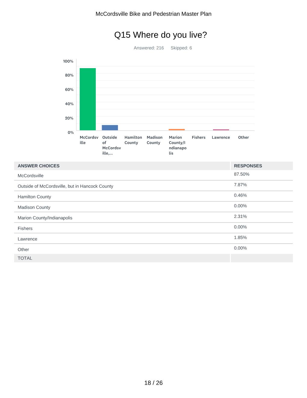
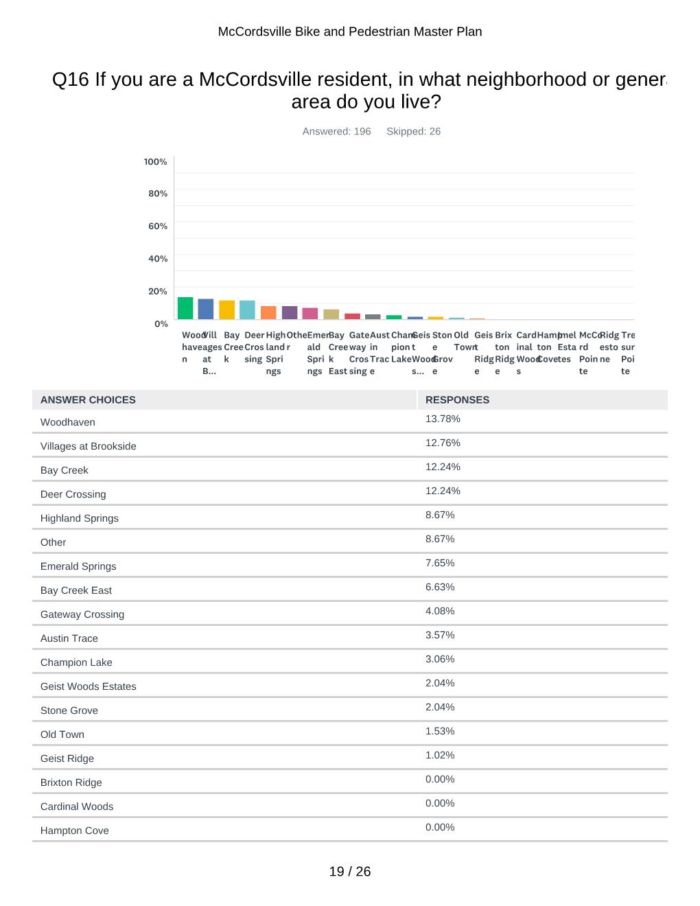
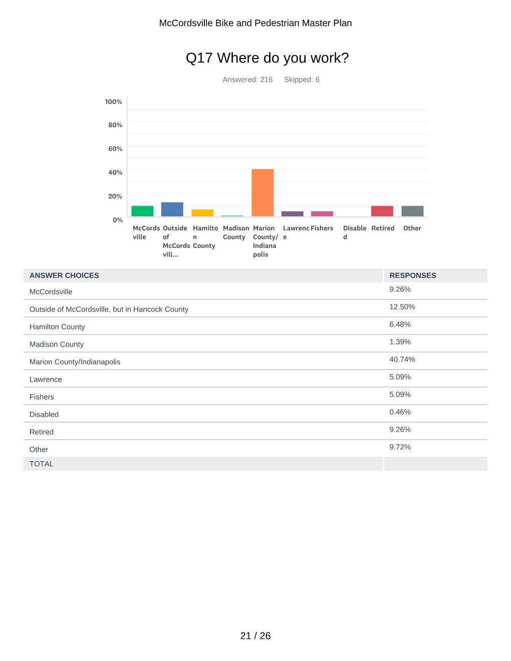
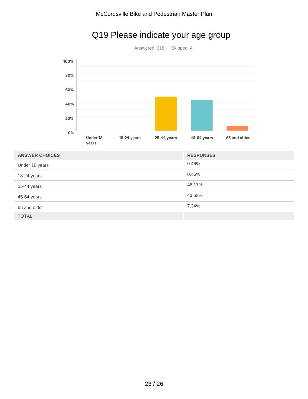
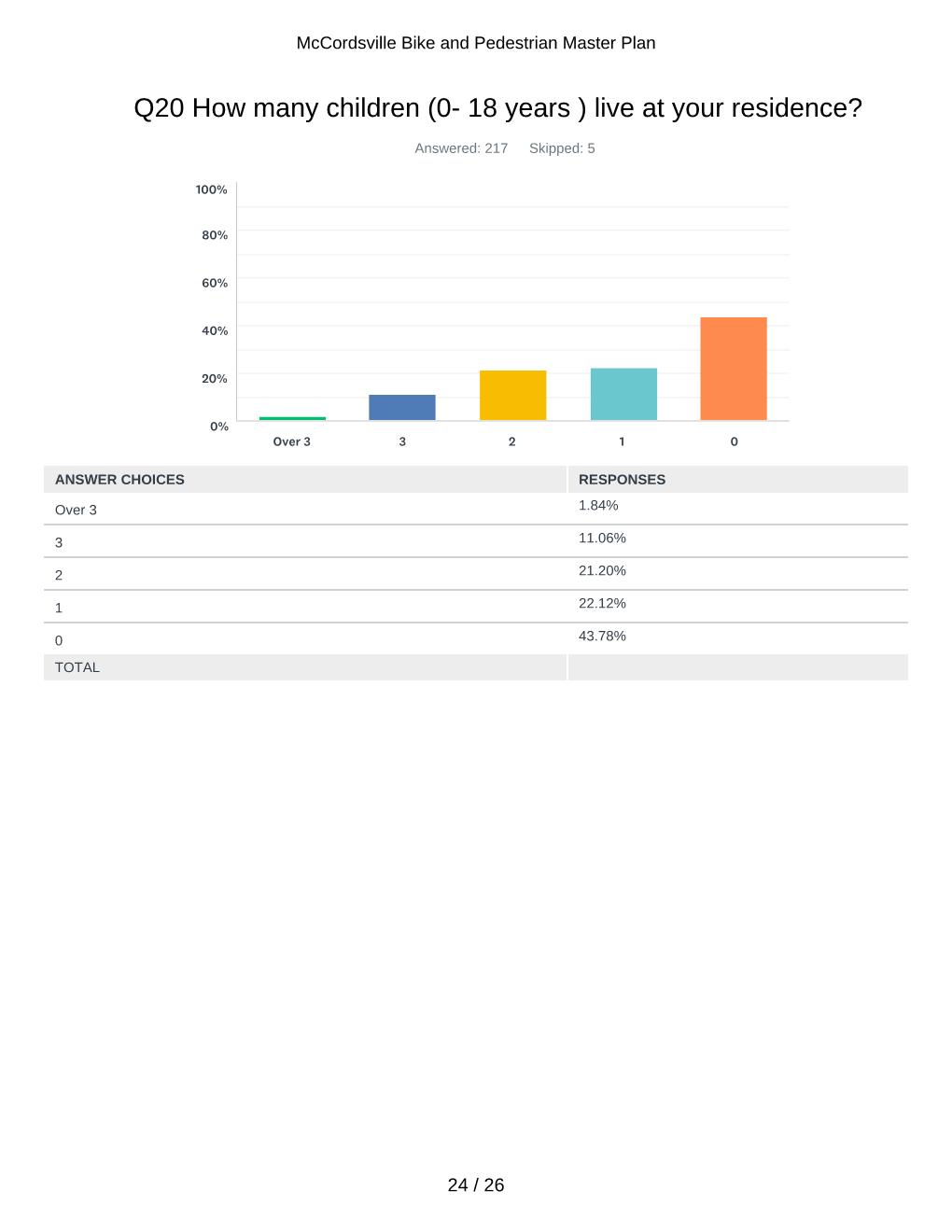
- Online Survey – published through an online portal that gathered over 220 results.
- Public Approval Process – a public forum to formally adopt the plan for the Town of McCordsville’s use.


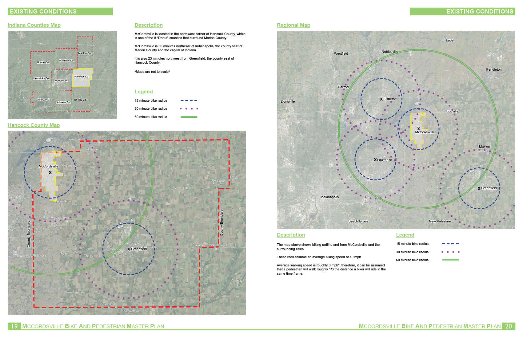
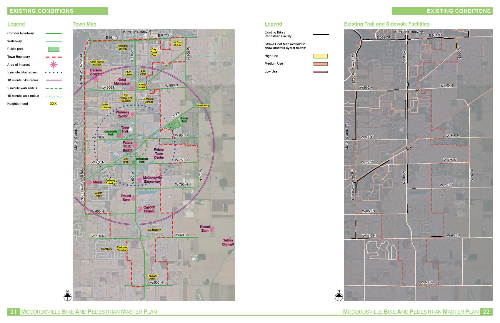
Proposed System
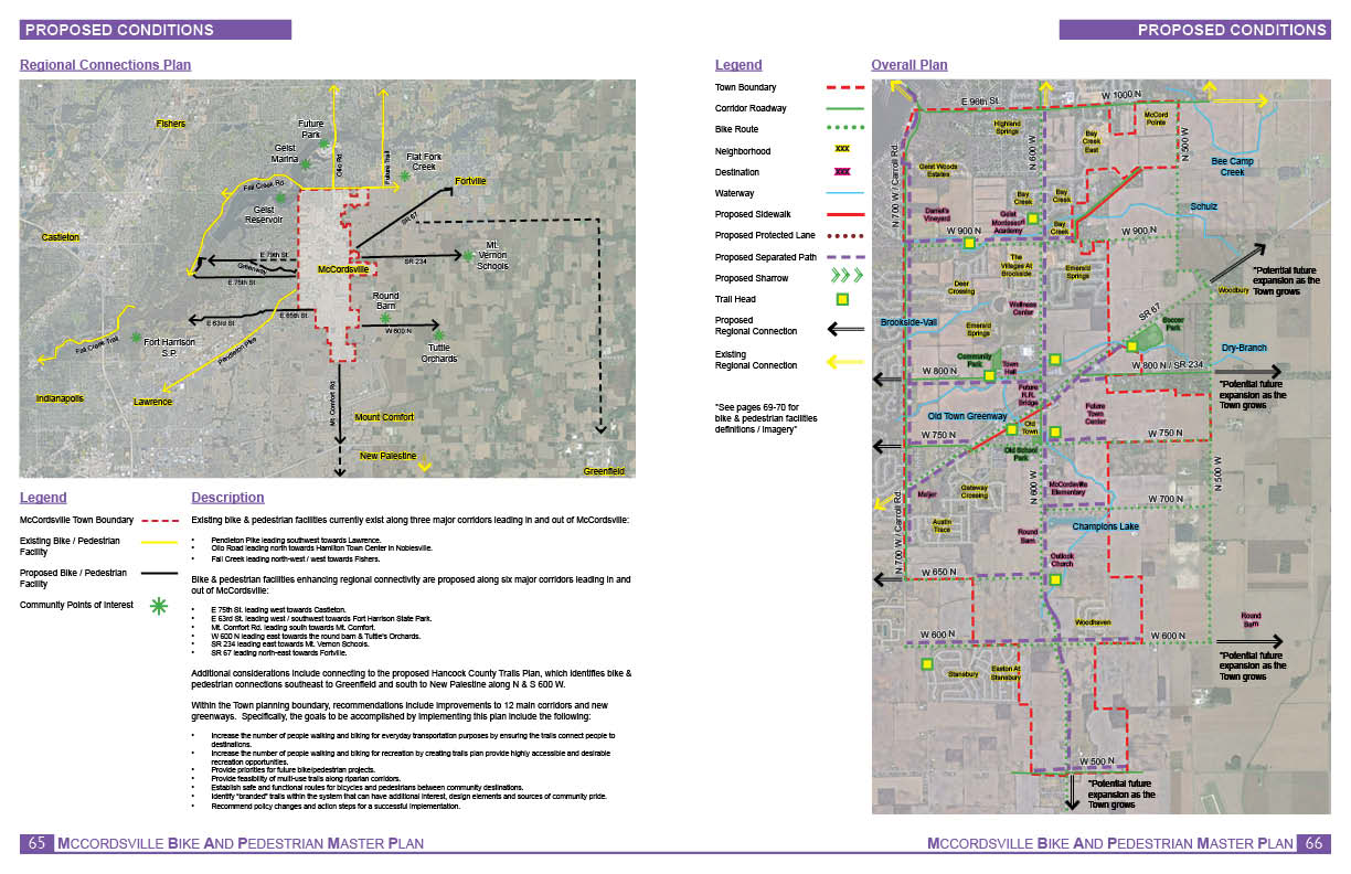
Existing bike & pedestrian facilities currently exist along three major corridors leading in and out of McCordsville:
1. Pendleton Pike leading southwest towards Lawrence.
2. Olio Road leading north towards Hamilton Town Center in Noblesville.
3. Fall Creek leading north-west / west towards Fishers.
Bike & pedestrian facilities enhancing regional connectivity are proposed along six major corridors leading in and out of McCordsville:
- E 75th St. leading west towards Castleton.
- E 63rd St. leading west / southwest towards Fort Harrison State Park.
- Mt. Comfort Rd. leading south towards Mt. Comfort.
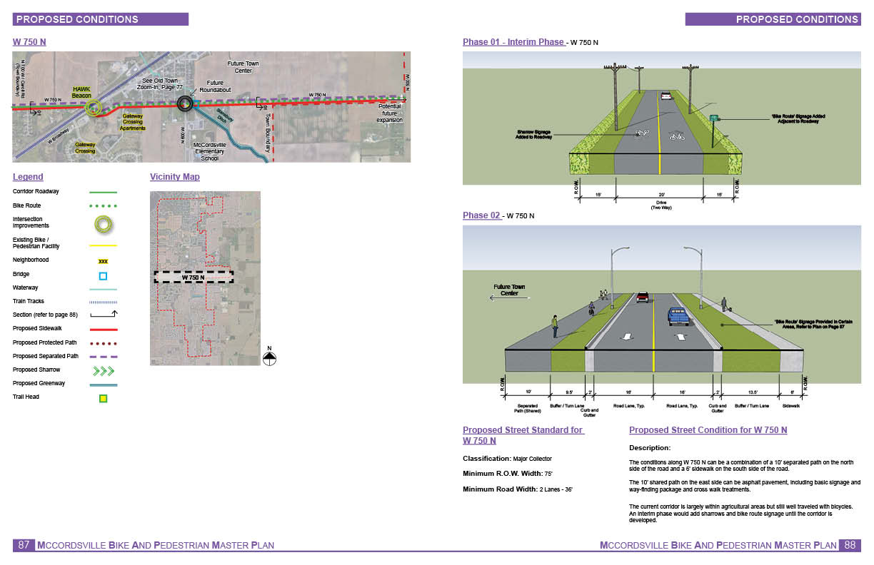
- W 600 N leading east towards the round barn & Tuttle’s Orchards.
- SR 234 leading east towards Mt. Vernon Schools.
- SR 67 leading north-east towards Fortville.
Additional considerations include connecting to the proposed Hancock County Trails Plan, which identifies bike & pedestrian connections southeast to Greenfield and south to New Palestine along N & S 600 W.
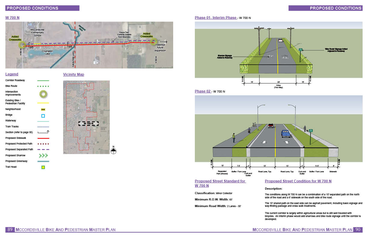
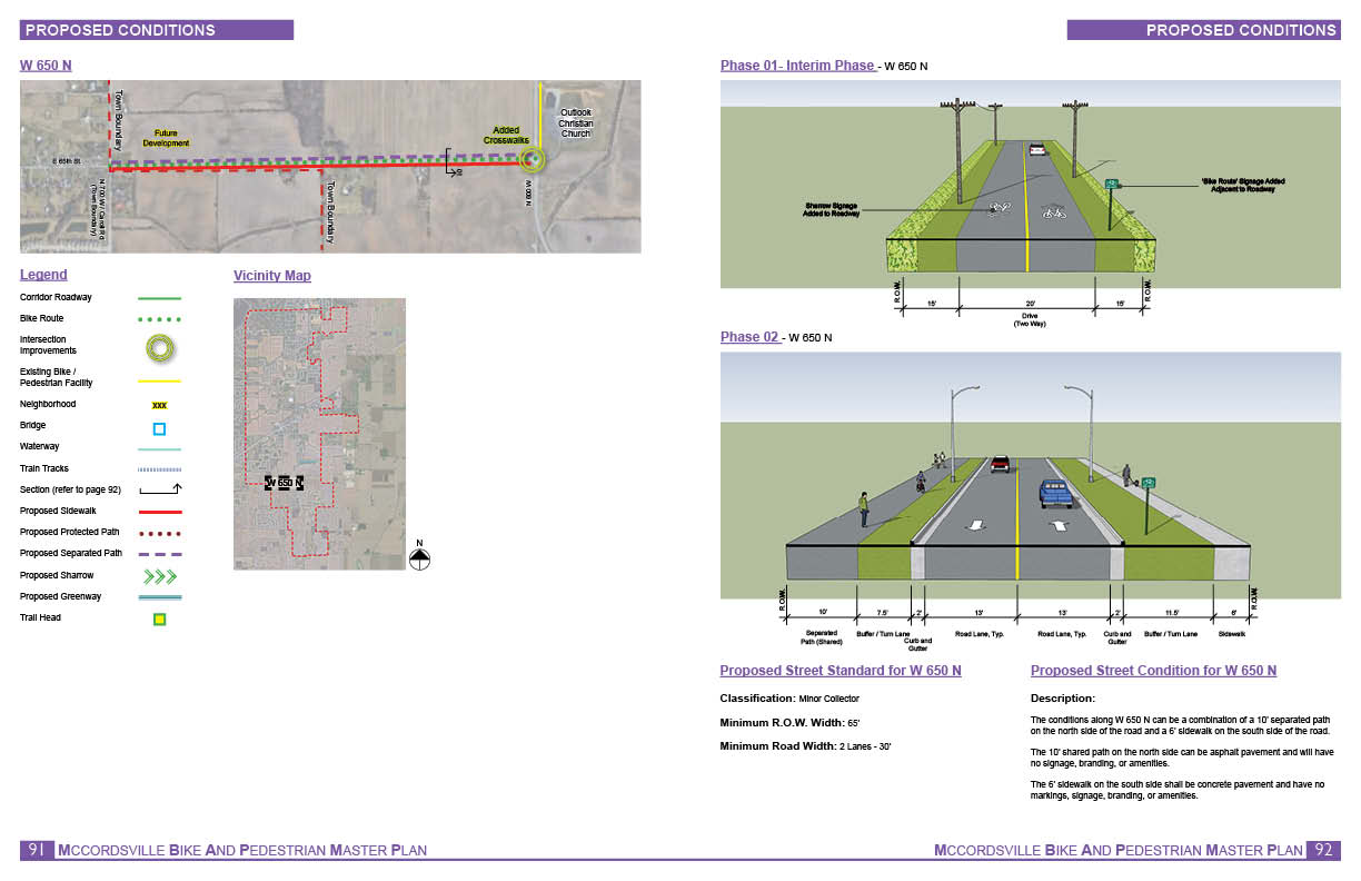
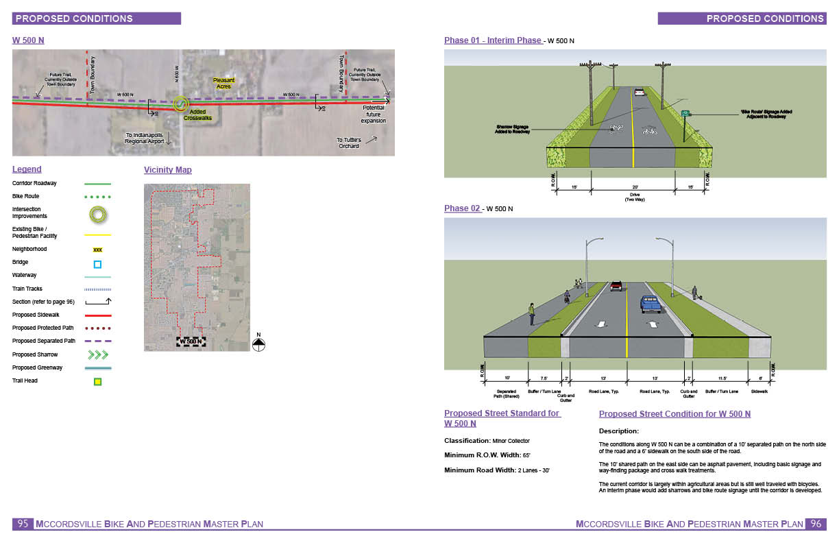
Within the Town planning boundary, recommendations include improvements to 12 main corridors and new greenways. Specifically, the goals to be accomplished by implementing this plan include the following:
- Increase the number of people walking and biking for everyday transportation purposes by ensuring the trails connect people to destinations.
- Increase the number of people walking and biking for recreation by creating trails plan provide highly accessible and desirable recreation opportunities.
- Provide priorities for future bike/pedestrian projects.
- Provide feasibility of multi-use trails along riparian corridors.
- Establish safe and functional routes for bicycles and pedestrians between community destinations.
- Identify “branded” trails within the system that can have additional interest, design elements and sources of community pride.
- Recommend policy changes and action steps for a successful implementation.


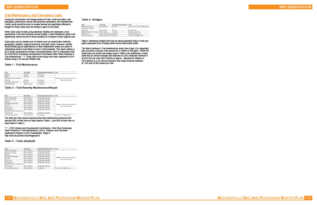
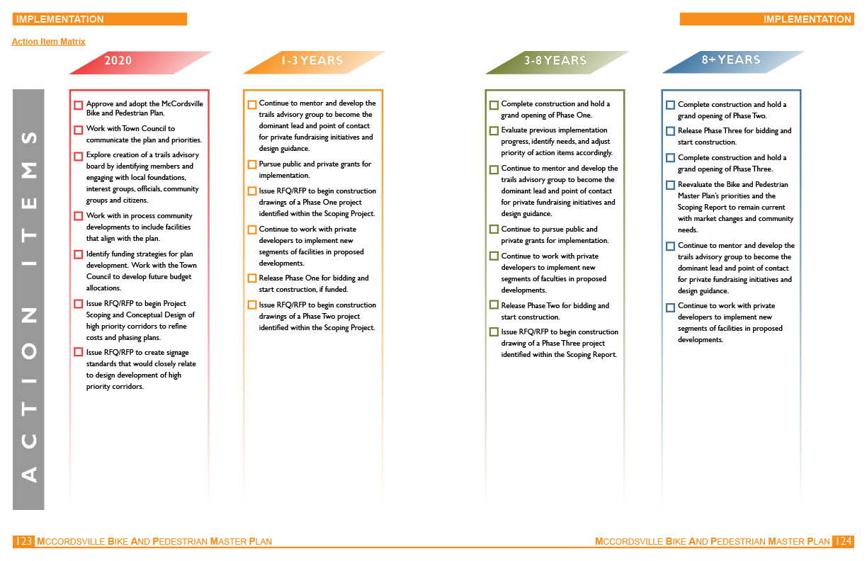
IMPLEMENTATION
Below you can find the Implmentation section information. To download a complete DRAFT of the booklet, click here.
Leave us a comment –
Oops! We could not locate your form.